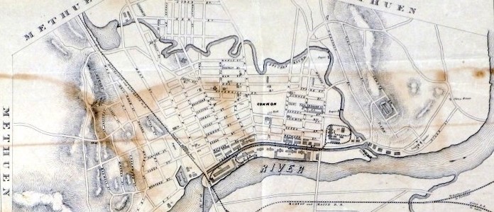
The city of Lawrence was originally developed due to its proximity to three rivers—Spicket, Shawsheen and Merrimack.
To see a series of maps of Lawrence that begins with the farmland of 1844 that was to become Lawrence, and proceeds through a 2008 Google satellite view -
The maps have been scaled and oriented so that they overlay one-another to help you see the evolution of the streets of Lawrence.
Note: In the 1880s, the Spicket River was a threat to public safety as it was used as an outlet for household garbage and sewerage and was a source of filth, smell and disease. To mitigate this, local engineers installed a sewer line along the river, and, confident of the purifying qualities of fast moving water, they straightened the path of the Spicket to allow for more rapid flow.
Be sure to compare maps from 1881 to 1889 to see the straightening of the Spicket!
Map project credit: Dave Russell